LIFE ON LAND
“Protect nature, preserve life — our planet depends on it!”
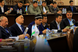
On April 16, 2024, at Mirzo Ulugbek Samarkand State University of Architecture and Construction, an international scientific-practical conference was held on the occasion of April 22 — International Earth Day. The conference, titled “Current Challenges in Implementing Achievements in Geomatics to Improve the Efficiency of Land Resource Use”, was organized in collaboration with the State Scientific-Design Institute “O‘zdavyerloyiha,” the Cadastre Agency of Samarkand Region, the Interregional Division of the Republican Aerogeodesy Center in Samarkand, and the Samarkand Regional Office of the State Cadastre Chamber.
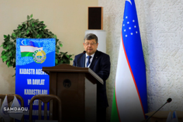
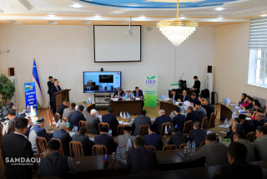
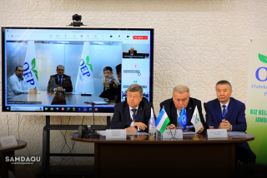
The international conference was attended by nearly 20 foreign expert scholars from research universities in Russia, Mongolia, Belarus, Ukraine, Turkmenistan, Kyrgyzstan, Kazakhstan, and Tajikistan, alongside local higher education scientists. The main objectives of the conference were to:
•Develop a collaborative scientific environment in the field of land resource management at the national and international levels;
•Provide scholars with opportunities to exchange ideas and experiences;
•Unite efforts for scientific and technological progress and support scientific activities;
•Guide researchers working in state cadastre and geoinformatics toward interdisciplinary studies;
•Expand the involvement of experts in international scientific communities;
•Strengthen international academic exchanges between higher education institutions (HEIs) and technical institutions;
•Facilitate the practical application of scientific achievements and innovative developments in land surveying and cadastre.
The following key topics were discussed at the conference:
•The emergence, current state, and development challenges of digitalization in land resource management;
•Land allocation, rational use, management, and protection of land resources: problems, solutions, and future prospects;
•Priority directions for applying digital technologies in land surveying, cadastre, and land monitoring systems;
•Ways to regulate legal relations in land management and improve the legislative framework;
•Issues related to the implementation of market assets and mechanisms in land relations;
•Use of modern technologies in geobotanical research of pastures and hayfields;
•Improvement of the land information database “YAT portal” and the state cadastre geoportal;
•Challenges in creating a unified state cadastre system and the national spatial data infrastructure;
•Problems in digitalizing land resource use and managing state cadastres, including geodetic and cartographic work, remote sensing, satellite systems, geomatics, and unmanned aerial vehicle technologies;
•Issues related to the innovative development of training highly qualified specialists and scientific-pedagogical staff in land management, cadastre, and land monitoring, as well as improving the professional qualifications of specialists in these fields.